Browse Home & Garden
-
Home & Garden

- Personal Care

- Hair Dryers and Stylers
- Hair Trimmers and Shavers
- Massagers and Therapeutic Products
- Media Storage and Accessories
- Novelties and Gadgets
- Personal Stereos and Accessories
- Sports and Leisure
- Stationery
- Toiletries
- Travelling Essentials
- Umbrellas
- Health and First Aid
- Beauty and Cosmetics
- Nail Brushes
Help
Choiceful Services
Choiceful for Business
Secure Shopping
Product Description
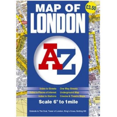
This A-Z map of London is a full colour, foldout street map of central London covering all of the Congestion Charging Zone and an area extending to: Maida Vale Regent's Park (part) St. Pancras International Station Shoreditch Tower Bridge Bermondsey (part) Walworth The Oval Cricket Ground (Kennington) Chelsea Kensington Bayswater This map of London is shown at a clear 6 inches to 1 mile (9.47 cm to 1 km) and features postcode districts, one-way streets and safety camera locations with their maximum speed limit. Also included are maps of: The central London Underground West End Cinemas West End Theatres Attached to the cover is a booklet containing the index to streets, selected flats, walkways and places of interest, place and area names, hospitals and hospices, National Rail, Docklands Light Railway and London Underground stations and River Bus Stops covered by this map.
Customers Viewing This Page May Be Interested in These Sponsored Links
Advertisement | Ad feedback
Technical Details
Boxed-Product Weight: 100.00g
Quick Code: QCHO062356
Delivery Destinations: Visit the Delivery Destinations Help page to see where this item can be delivered. Find out more about our Delivery Rates and Returns Policy
Item model number: 48354
Search Tags Associated With This Product
Reviews
Questions & Answers
More to Explore
Email a friend about this product!
Seen a mistake on this page? Tell us about it!


 Loading, please wait


